Wales packs a lot of different water into a small country. In one week you could paddle a glacial lake under Yr Wyddfa, drift along a canal through the Bannau Brycheiniog, run a dam-fed whitewater river and finish in a sheltered harbour on the Pembrokeshire coast. This guide picks seven launches from the PaddlePal Finder listings for Wales, spread across the north, the middle and the south coast, and adds the practical bits: when to come, where to base yourself, how to get about with a board on the roof, and what to check before you launch.
Why paddle in Wales
Three things make Wales worth the drive. The lakes of Eryri (Snowdonia) and the Bannau Brycheiniog (Brecon Beacons) are natural, mostly motor-free and sit inside national parks, so a beginner gets calm water and a serious backdrop at the same time. The canals, the Monmouthshire & Brecon in the south and the Llangollen in the north-east, are flat, narrow and easy to shuttle, and they pass through scenery most canals cannot offer. And the coast, particularly Pembrokeshire, gives sea paddlers sheltered bays, cliffs, caves and seals within a few miles of each other.
It rains here, and the rivers rise quickly when it does. That is part of the appeal for whitewater paddlers and a reason for everyone else to keep plans flexible and have a lake as a fallback.
When to go
Late spring to early autumn is the reliable window: longer days, warmer water and lake permit offices open. July and August are busiest around Llanberis, Bala and Tenby, so arrive early or go midweek. September is often the sweet spot, with warm water, quieter shores and settled spells. Outside the season the water is cold enough to need proper kit and a conservative plan, though a still winter morning on a Welsh lake is hard to beat. The Tryweryn's whitewater depends on dam releases rather than the weather, so check the release schedule before travelling.
Where to paddle
Llyn Padarn, Llanberis
Llanberis sits at the foot of Yr Wyddfa (Snowdon) and Llyn Padarn is the lake in the middle of the village, about two miles long with slate quarry terraces on one side and the mountain railway on the other. It is the easiest place in North Wales to get a first paddle in: flat water, a gently shelving shore, and everything you need within walking distance. The Padarn Lake lagoons listing records parking, toilets, a café and a pub, which is about as convenient as a launch gets. The lake is managed by the council, so check for any launch charge at the country park. See the listing on PaddlePal Finder.
Llyn Gwynant, Nant Gwynant
A few miles over the pass from Llanberis, Llyn Gwynant is smaller, wilder and quieter, sitting in a steep-sided valley with the southern ridges of Yr Wyddfa above. The launch at the campsite end of the lake records parking, and staying on site means you can be on the water at first light before the road fills up. The lake is privately managed and paddlers launch with a permit from the campsite, so pick one up when you arrive. Pair a morning paddle with the Watkin Path, which starts nearby. See the listing on PaddlePal Finder.
Llyn Tegid (Bala Lake)
The largest natural lake in Wales runs nearly four miles from Bala to Llanuwchllyn, with the Aran mountains at the far end. The foreshore launch at the Bala end records parking, and it is where the national park's lake wardens are based: powered craft are banned, buoyancy aids are expected, and every paddler needs a permit, bought from the wardens' office or the pay-and-display machines before launching. Wind builds real chop by afternoon, so mornings are calmer for beginners. Whitewater paddlers come to Bala for a different reason: the Afon Tryweryn and the National White Water Centre at Canolfan Tryweryn are a short drive up the road, with grade 3 to 4 rapids on release days. See the Bala Lake listing and the Canolfan Tryweryn listing on PaddlePal Finder.
Horseshoe Falls, Llangollen
Horseshoe Falls is Thomas Telford's curved weir on the River Dee, built to feed the Llangollen Canal, and the launch ramp beside it is the natural start for both kinds of paddling here. The listing records parking and toilets. Turn onto the canal and you have flat, narrow water that runs east through Llangollen and, a few miles on, crosses the Pontcysyllte Aqueduct some 38 metres above the Dee, a UNESCO World Heritage Site. Stay on the river below the weir and it is a different sport: the Dee through Llangollen is whitewater, with the Serpent's Tail and Mile End Mill rapids used by slalom paddlers and rafting outfits. The canal is a Canal & River Trust waterway, so you will need a licence; British Canoeing's On the Water membership includes one. See the listing on PaddlePal Finder.
Monmouthshire & Brecon Canal, Brecon
The Mon & Brec is the gentlest water in South Wales: a rural canal that starts in Brecon and runs south-east along the Usk valley inside the Bannau Brycheiniog National Park, with almost no current and long stretches between locks. The Brecon Canal Launch Point listing records parking, and a neighbouring pin on the same basin notes a café. From Brecon it is an easy paddle to Brynich Lock and Pencelli, and the towpath means you can be collected almost anywhere for a one-way trip. As with the Llangollen, this is a Canal & River Trust canal and needs a licence. See the listing on PaddlePal Finder.
Llangorse Lake
Ten minutes east of Brecon, Llangorse is the largest natural lake in South Wales and a very different proposition from the canal: open water, reed beds, a lot of birdlife and the Black Mountains as a backdrop. The public launch pin records no facilities, and a neighbouring Llangorse pin records parking, so expect a basic put-in. The lake is a protected site and launching is controlled from the lakeside, so check the current arrangements when you arrive. It is a good choice for a calm evening paddle after a day on the hills. See the listing on PaddlePal Finder.
Tenby Harbour
Tenby is the coastal entry in this guide because it offers sheltered sea paddling straight out of a walled seaside town. The harbour listing records parking and sits behind the headland, so on most days it gives flat water to warm up on before you head out past the lifeboat station towards Castle Beach and, on a calm day with the tide right, along to Caldey Island. North Beach and South Beach have their own launch pins if you would rather start on sand. This is tidal water with a big range and boat traffic in summer, so plan around the tide and keep an eye on the wind. See the listing on PaddlePal Finder.
Routes to try
Paddlers have shared GPX routes on PaddlePal Finder for several Welsh waters. Three that suit a day out:
- Llangollen Canal, Horseshoe Falls to Chirk: 16.1 km of flat water that includes the Pontcysyllte Aqueduct crossing.
- River Wye, Glasbury to Whitney-on-Wye: 17.1 km of easy moving water on the Wye's borderland stretch, passing Hay-on-Wye.
- Llangollen Canal, Ellesmere to Chirk: 17.7 km through the Shropshire meres end of the same canal.
Beyond the water
Wales rewards a rest day. In the north, Llanberis has the Snowdon Mountain Railway and the National Slate Museum at the lake's edge, and Zip World's quarry lines are a short drive away. Betws-y-Coed and Beddgelert are the villages to wander. Llangollen has a heritage steam railway along the Dee. Around Brecon, Pen y Fan is the obvious hill, Hay-on-Wye is the bookshop town on the Wye, and the whole national park is an International Dark Sky Reserve, so a clear night is an event in itself. In Pembrokeshire, the coast path runs through Tenby, boats cross to Caldey Island from the harbour, and the beaches between Saundersfoot and Manorbier are as good as any in Britain.
Where to stay
Base yourself on the water where you can. Several campsites appear on the finder as launch points in their own right: Glanllyn and Pen y Bont on Llyn Tegid, the Gwynant campsite on Llyn Gwynant, and the Caravan and Motorhome Club sites at Brecon Beacons and Aberbran near the Usk. For beds, Llanberis and Betws-y-Coed cover the north with everything from hostels to hotels; Bala is a small market town with pubs and B&Bs; Llangollen has riverside hotels a few minutes' walk from the launch; Brecon, Crickhowell and Hay-on-Wye are the comfortable bases for the south; and Tenby and Saundersfoot have the seaside guesthouses and holiday lets.
Getting there
Wales is a car country for paddlers. The M4 brings you to Cardiff and Swansea and on to Pembrokeshire; the A470 runs the length of the country from Cardiff through Brecon to the north; the A5 comes in from Shrewsbury to Llangollen and on to Betws-y-Coed and Llanberis. By train, Tenby has its own station on the West Wales line, Llangollen is close to Ruabon and Chirk, and Bangor and Llandudno Junction serve the north coast, with local buses (including the Sherpa network around Yr Wyddfa) doing the last leg. Cardiff has an airport; for the north, Manchester and Liverpool are the practical arrivals. Inflatable boards travel well on the train; hard boards and kayaks want a car.
Before you launch
Access is the thing to get right in Wales. There is no general right to paddle rivers, so stick to established launches like the ones above, use the finder's pins as a starting point rather than a guarantee, and check locally when in doubt. The canals need a Canal & River Trust licence (British Canoeing membership covers it). Llyn Tegid and Llyn Gwynant need permits bought on the day. The Wye has a long-established right of navigation for most of its length, which is why hire outfits run trips from Glasbury all summer.
Finder pins also flag hazards worth knowing. On the Usk near Brecon there are pins for a "deceiving weir" and a dangerous bridge on the Abercamlais estate, and pins around Llyswen and Boughrood ask people not to park at the school; respect that or the access goes. On the Dee, the weirs at Horseshoe Falls and Pentrefelin are marked for a reason. On the Pembrokeshire coast, the sea off Manorbier and Penally is a military danger area when red flags fly; the MOD publishes firing times, so check before a coastal trip west of Tenby.
Finally, the usual: wear a buoyancy aid (the Llyn Tegid wardens insist), check the forecast and, on the coast, the tide, and tell someone your plan.
Plan it with PaddlePal
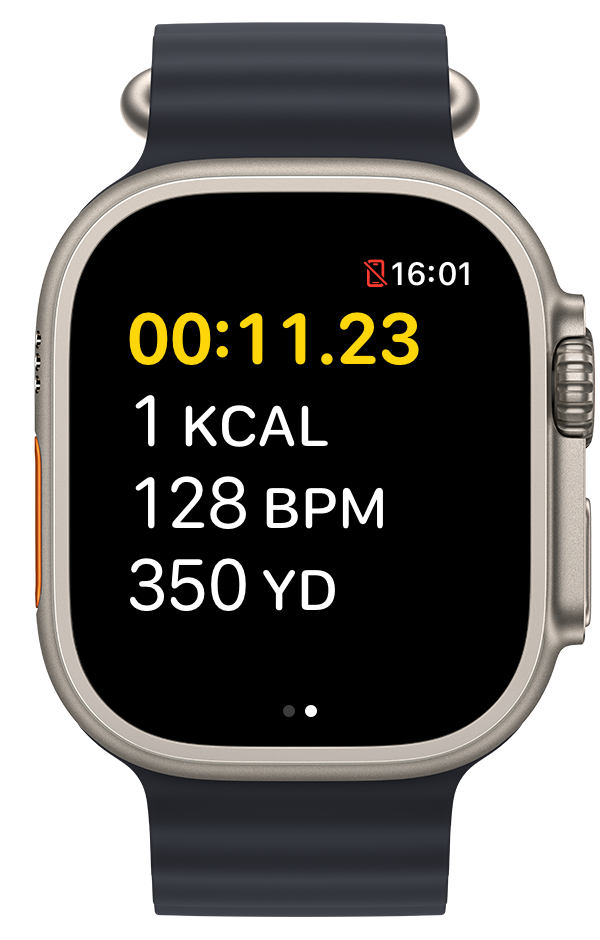
These seven are a starting point. The finder lists more than 700 spots across Wales, including plenty on Anglesey, the Llŷn and the Gower that did not make this guide. Browse the full Wales listings on PaddlePal Finder, download a shared route as GPX, then plan your line in the PaddlePal app and track the paddle from your wrist.
Frequently asked questions
Do I need a licence to paddleboard in Wales?
On canals, yes: the Monmouthshire & Brecon and Llangollen canals are Canal & River Trust waterways and need a licence, which British Canoeing membership includes. Llyn Tegid and Llyn Gwynant sell day permits on site. The sea needs no licence.
Where is the best place for beginners to paddleboard in Wales?
Llyn Padarn at Llanberis and the Mon & Brec canal at Brecon are the two easiest: flat, sheltered water with parking, toilets and cafés close by.
Can you paddle across the Pontcysyllte Aqueduct?
Yes. It is part of the Llangollen Canal, and the Horseshoe Falls to Chirk route on PaddlePal Finder crosses it. You will need a canal licence and a head for heights.
When is the best time of year to paddle in Wales?
May to September for warm water and open permit offices; September is often the calmest and quietest month. Whitewater on the Tryweryn depends on scheduled dam releases rather than the season.
Are there sea kayaking spots in Wales for beginners?
Tenby Harbour is a sheltered start on the south coast. Anywhere on the open coast, plan around the tide, check the wind and avoid the Manorbier and Penally ranges when firing is scheduled.